Spatial Data Warehouse for Belize
For local and foreign researchers and students alike it may be difficult to access up to date GIS datasets for Belize. Recently revised GIS datasets for Belize that have been verified for geospatial accuracy and consolidated with complete ArcGIS metadata are being made available through the Spatial Data Warehouse at the Biodiversity and Environmental Resource Data System for Belize (BERDS). These datasets are released as they become available and constantly updated.
Datasets in the warehouse are available for download in winzip (.zip) archive format. Each archive contains a complete ESRI ArcGIS (versions 3 through 10) and QGIS compatible shapefile set along with appropriate ArcGIS generated metadata records.
Some of the datasets available include:
Jan Meerman has been creating datsets for Belize since 2001 with the publishing of the first version of the Belize Ecoystems Map. For example: the maps below (click to download large version, they can be dowloaded for free for educational purposes) were produced during the 2010 Land Use Policy Formulation.
|
|
|
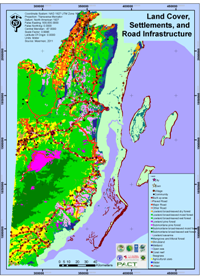
| Land Cover, Settlements and Road Infrastructure |
Protected Areas including Private PA candidates |
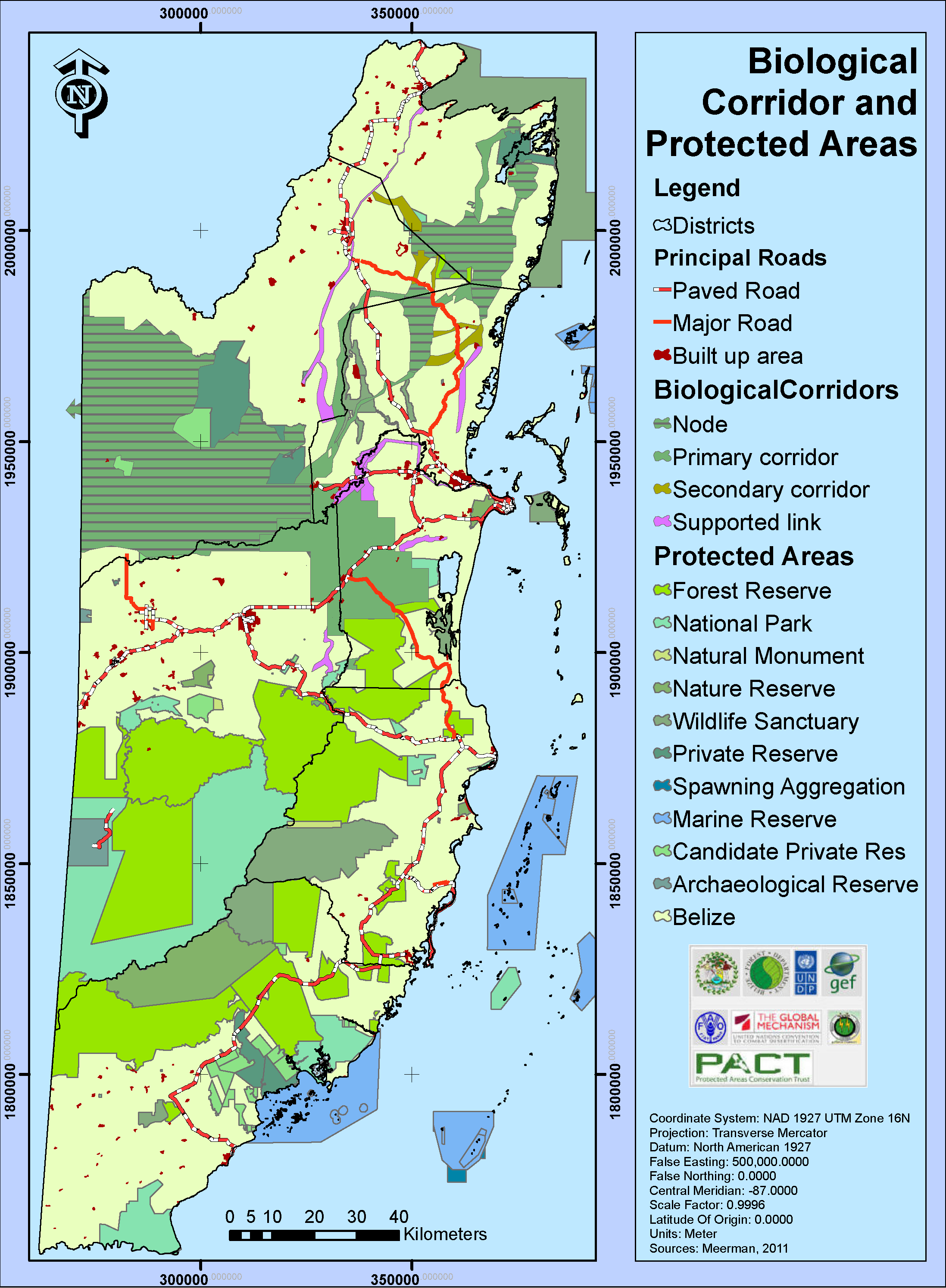
Biological Corridors and Protected Areas |
 |
 |
 |
| Aquaculture and Selected Crops in Relation to Land Cover |
Agricultural Land Value, Aquaculture and Selected Crops |
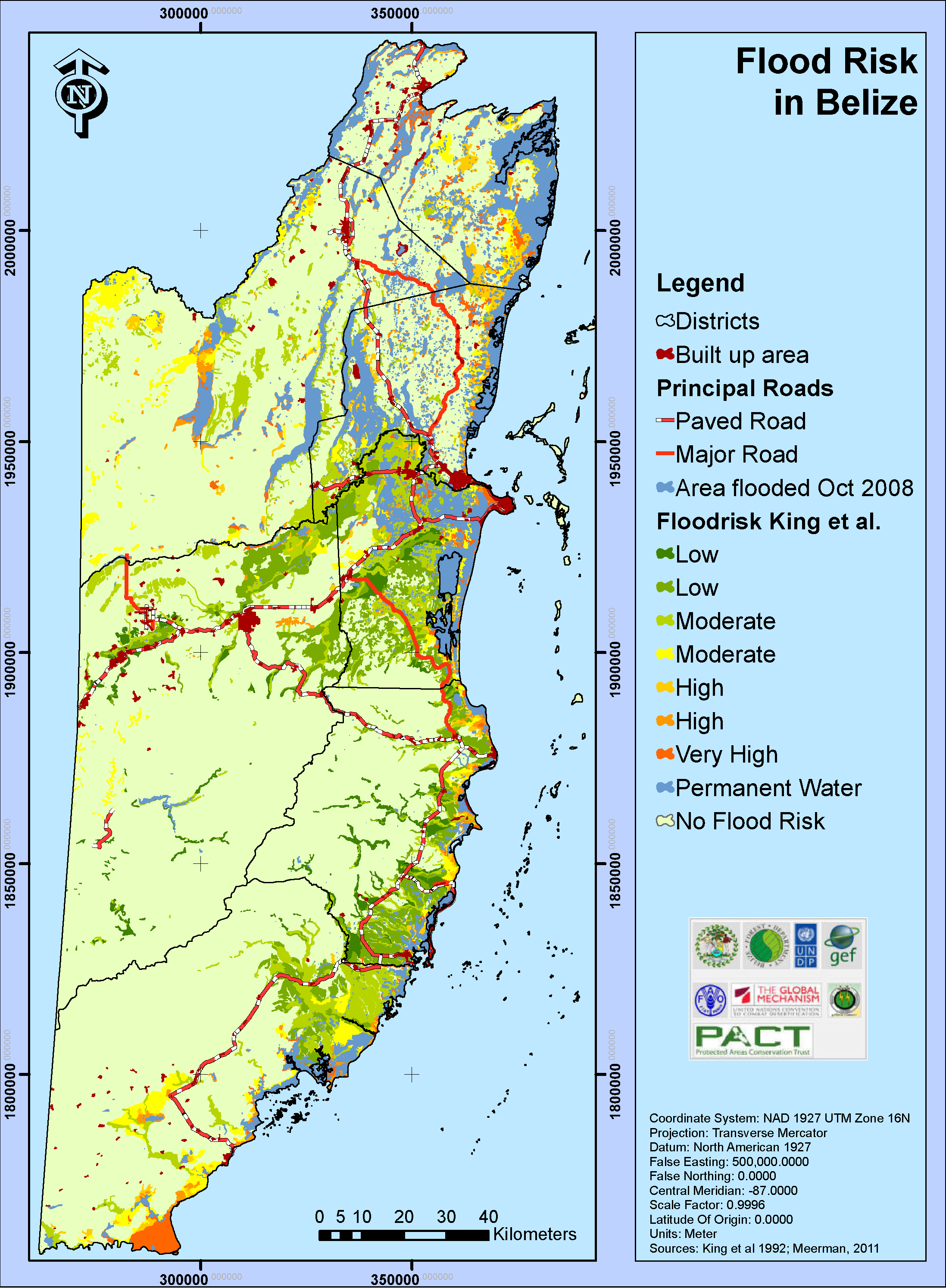
Flood Risk in Belize
|
 |
 |
|
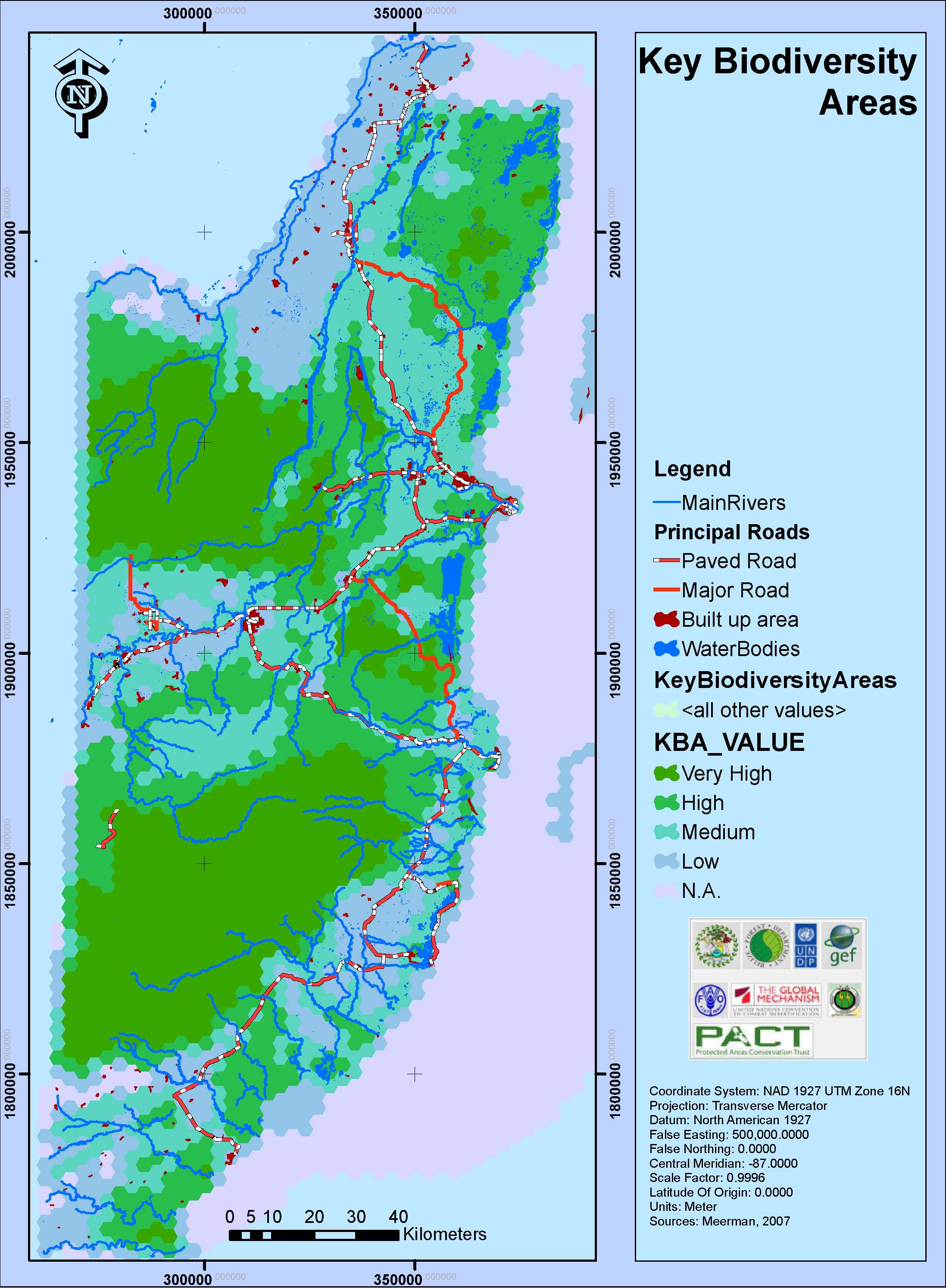
Key Biodiversity Areas (KBA's) |
Land Degradation Potential
|
|
Go to the spatial data warehouse or contact Jan Meerman
Back to top
About Belize|Administrative|Publications|Species
Lists|Projects|Links|HOME |